
Expert report review
Neighbor's survey is wrong: which errors does a reviewing surveyor check?
When a neighbor's survey moves the line onto your lot, a second surveyor checks it before anyone goes to court: which deeds and plats it used, which monuments it found, how it treated fences and walls, and how its measurements compare with the record. In a 2023 New Jersey case one survey showed a 5.88-foot encroachment and the other put the line about two feet from the house.

Why do two surveys of the same line disagree?
Because the surveyors worked from different evidence or read the same evidence differently: a monument accepted by one and rejected by the other, a missing deed of the adjoining parcel, a call read another way, a fence given more weight.
Steve Tytler, writing about conflicting surveys in a HeraldNet column of September 3, 2010, listed common causes: a monument that was moved or replaced, more than one monument at a corner, and a surveyor who started from a distant reference point. He also wrote that surveyors differ in skill.
Court records give examples of each. In Burleson v. United States, a boundary case in the Western District of Tennessee, the government's surveyor did not rely on a 1941 survey because, as he explained, its beginning point "has been washed away by the Hatchie River" and he did not find a marked box elder tree. He used a tree line instead and checked it against other evidence. The magistrate judge noted that Bennett "reaches a different conclusion" than the plaintiffs' expert, Don Cole.
In Thompson v. Jones, decided by the Appellate Division of the New Jersey Superior Court on November 9, 2023, the Joneses' survey showed a 5.88-foot encroachment, while the Thompsons' surveys put the line about two feet from the Joneses' house. The trial judge found the Joneses' survey questionable, partly because it relied on the Joneses' own description of the property and lacked a title report.
A reviewing surveyor does not start by remeasuring. He starts by finding the first input on which the two surveys part: a document, a monument or a reading of a call. Everything downstream of that point follows from it.
Which records does the reviewer check first?
The deed and plat of your lot, the deeds of each adjoining parcel and the prior surveys of the block. An ALTA/NSPS survey must start from the current record description of the property and of its adjoiners.
The Minimum Standard Detail Requirements for ALTA/NSPS Land Title Surveys, in the edition effective February 23, 2026, are the standard that ALTA and NSPS adopted for land title surveys. Section 4.C.i lists among the records the surveyor obtains "The current record descriptions of any adjoiners to the property to be surveyed." Both the 2026 text and the 2021 edition, effective February 23, 2021, make an exception for adjoiners that are lots in platted, recorded subdivisions.
A survey ordered by a homeowner may claim to meet only the minimum standards of the state where the land lies, and the reviewer checks which standard the plat states. The ALTA/NSPS list is still a useful yardstick, because a boundary between two parcels cannot be retraced from one deed alone. The reviewer asks for the documents the neighbor's surveyor used and compares them with his own search of the record.
Recorded documents can be used in court. Federal Rule of Evidence 803(14) excepts from the hearsay rule "The record of a document that purports to establish or affect an interest in property" if the record is kept in a public office and a statute authorizes recording documents of that kind there. Rule 803(15) covers a statement in such a document if the matter stated was relevant to the document's purpose, "unless later dealings with the property are inconsistent with the truth of the statement or the purport of the document."
The Thompson trial judge's concern is the opposite case: a survey built on the client's own description of the property, with no title report behind it.
How are the monuments in the neighbor's survey checked?
Against the plat and the ground: what was found, its size, character and type, its relation to the surface and whether it is the original marker. ALTA/NSPS section 5.A.i requires that information for every monument found.
The 2026 ALTA/NSPS text of section 5.A.i requires the surveyor to locate and describe "The location, size, character, (including relationship to surface of the ground), and type of any monuments found." The plat then shows each monument with that description.
The reviewer compares that list with three things: the monuments called for in the deeds and recorded plats, the monuments shown on earlier surveys of the same corners, and what is on the ground today. A pipe of a different size than the one called for in a 1950s plat may be a replacement. A pin set by a later surveyor at a different place may be one of two monuments at the same corner, the situation Tytler described.
When the original monument is gone, the surveyor relies on other evidence. In Burleson the court accepted that approach: the government's surveyor checked the tree line pointed out by Fish and Wildlife Service personnel against the deeds to adjoining tracts, against "boundaries resolved in a 1979 lawsuit involving adjoining tracts" and against aerial photographs. The magistrate judge also wrote that "The lack of definitive monuments would appear to make it difficult to plot the boundaries" from the 1941 survey alone. A review asks the same question of the neighbor's survey: what replaced the missing monument, and what else confirms it?
Does the survey show fences, walls and other evidence of possession?
It should. ALTA/NSPS section 5.C.i requires the character and location of evidence of possession or occupation along the perimeter. A long-standing fence the survey omits can matter under state boundary law.
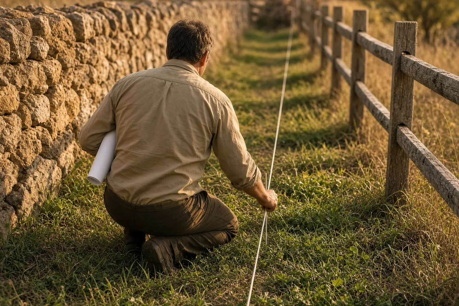
The 2026 ALTA/NSPS text requires "The character and location of evidence of possession or occupation along the perimeter of the surveyed property." A plat that shows the record line but leaves out the neighbor's fence, the old stone wall or the hedge along the line gives the reviewer no way to compare the line with how the land has been used.
Possession evidence matters in court for two reasons. First, it can be the best evidence of where an original line was marked. Second, many states have rules under which a line that neighbors have treated as the boundary for a long time can bind them, and each state sets its own conditions. The reviewer does not decide those legal questions; he records what stands where and since when, so counsel can apply the state rule.
Old community knowledge can also be evidence. Rule 803(20) excepts from the hearsay rule a reputation in a community, arising before the controversy, concerning boundaries of land in the community. The advisory committee note says the reputation "is required to antedate the controversy, though not to be ancient." A reviewer who interviews long-time neighbors notes who said what and when they learned it.
How does the reviewer test the measurements?
By comparing measured and record dimensions, checking the basis of bearings and testing the precision between corners. ALTA/NSPS sets a maximum relative positional precision of 2 cm, or 0.07 feet, plus 50 parts per million.
Section 3.E.i of the ALTA/NSPS standard defines relative positional precision as the length of the semi-major axis of the error ellipse for the position of one boundary corner relative to an adjacent corner, at the 95 percent confidence level. Section 3.E.v sets the maximum allowable value at "2 cm (0.07 feet) plus 50 parts per million (based on the direct distance between the two corners being tested)." The 2026 edition kept that figure.
On a 100-foot line, 50 parts per million adds 0.005 feet to the 0.07 feet. If the neighbor's survey and yours differ by a few hundredths of a foot at a corner, the difference may sit inside the precision of both. If they differ by several feet, as in Thompson, measurement precision does not explain it, and the cause lies in the evidence each surveyor used.
Two plat items make the comparison possible. Section 6.B.iii requires the plat to show and distinguish measured or calculated dimensions "Where a measured or calculated dimension differs from the record by an amount deemed significant by the surveyor." Section 6.B.iv requires "The basis of bearings and, where it differs from the record basis, the difference." A survey with bearings rotated from the deed basis and no stated difference cannot be compared with the deed until the rotation is found.
What if the survey shows a gap or an overlap with the neighbor's parcel?
The survey should identify its extent. Under the 2026 ALTA/NSPS text the surveyor must also disclose gaps or overlaps to the insurer and the client before or upon delivery of the final plat or map.
Section 6.B.vii requires the plat to identify the extent of any gaps or overlaps between the boundaries of the surveyed property and its adjoiners. The same item covers gaps or overlaps between multiple parcels in one survey and requires the surveyor to disclose any gaps or overlaps found to the insurer and the client before or upon delivery of the final plat or map. The 2021 edition already contained both requirements.
An overlap means two deeds describe the same strip. A gap means neither deed reaches it. Neither is resolved by measuring again. The reviewer plots both descriptions on one drawing, computes the area of the strip and traces the cause to the deeds: a call that one deed carries and the other does not, a different starting point, or a later deed that conveyed more than the grantor had.
The legal effect of an overlap is a question for counsel and, if needed, the court. The reviewer's job is to show where the strip lies, how large it is and which document produced it.
What should you ask the neighbor's surveyor for?
The field notes, the list of monuments searched for and found, the record documents used, the basis of bearings, the computations behind each corner and any title report. These items let a reviewer repeat the work.
Tytler's column suggested two first steps when surveys conflict: compare both surveys with the legal description, and ask the original surveyor to explain the differences. He also suggested checking the title insurance policy. Standard policies often do not cover boundary disputes, he wrote, but the title company may still help by researching the legal description.
A request to the neighbor's surveyor is more useful when it names documents. A reviewer can work with the field notes and coordinate list, the record documents that were plotted, the description and location of each monument found, the reference used for bearings, and the computation of any corner that was set rather than found. In Thompson the trial judge noted that one survey lacked a title report, and that gap became part of the reason the judge distrusted it.
If the surveyor will not share the file, the request can wait for discovery. Once a case is filed, the neighbor's surveyor becomes an expert or a witness, and the rules on expert reports and depositions apply.
Can the neighbor's survey rely on what the neighbor told the surveyor?
It can use the owner's account as one piece of evidence if the deeds and the ground support it. A West Virginia federal court accepted such input; a New Jersey trial judge distrusted a survey built on it.
In Lawson Heirs Inc. v. Skyway Towers, LLC, decided March 22, 2019, the plaintiff argued that one of the defendants' surveyors had learned from the defendant, Howard Farley, where Farley thought the boundary was. Judge John T. Copenhaver, Jr. of the Southern District of West Virginia wrote that this fact "is not disqualifying." He found that the surveyors had consulted the applicable deeds, that one of them had viewed the property on the ground, and that they had used acceptable methods and reliable principles.
In Thompson the trial judge found the Joneses' survey questionable partly because it relied on the Joneses' own description of the property and lacked a title report. The Appellate Division did not resolve the dispute over the surveys. It held that the trial court should have allowed the Joneses to present their expert and remanded for a new trial.
The two cases point to the same check. The reviewer asks whether the owner's account was tested against the deeds, the plats and the ground, or whether it replaced them.
Is a review enough, or do you need a new survey?
A desk review finds gaps in records and reasoning. A field check or a new survey is needed when the dispute turns on where a monument or fence stands; in litigation, entry comes through Rule 34.
A desk review works from the neighbor's survey, its notes and the record. It can show that an adjoining deed was never consulted, that the basis of bearings was not stated, or that the plat shows no evidence of possession. It cannot confirm that an iron pin found in the field is the original monument.
When the dispute reaches court, Rule 34(a)(2) of the Federal Rules of Civil Procedure lets a party request entry onto land the other party possesses or controls "so that the requesting party may inspect, measure, survey, photograph, test, or sample the property." The request must describe the items to be inspected with reasonable particularity and specify a reasonable time, place and manner. The response is due in writing within 30 days after service.
Skipping the field can be costly later. In Town of Alburgh v. Murphy, decided by the Vermont Superior Court on August 11, 2026, a surveyor gave an opinion about the location of a historic road without a physical inspection and wrote that "Additional work, including physical inspection, is necessary to confirm the exact location." The court treated the missing inspection as a matter of weight, but ordered the party that offered him to pay the other side's fees for a second deposition and for the motion.
If the survey is wrong, can the surveyor be held liable?
Under state law, a surveyor who falls below the standard of care can be liable. In Graves v. S.E. Downey the Maine Supreme Judicial Court upheld a judgment after a house built on a faulty survey was moved.
In Graves v. S.E. Downey, Registered Land Surveyor, P.A., 2005 ME 116, decided November 22, 2005, the owners' contractor had relied on a survey by the defendant. After the house was built, the Park Service told the owners it sat north of their property line, on land the Park controlled. They moved the house at a cost of $110,589 and sued for breach of contract and professional negligence.
Justice Calkins, writing for the court, described the standard as "that degree of care that an ordinarily competent surveyor would exercise in like circumstances." The trial court relied on expert testimony about that standard, and the Supreme Judicial Court affirmed the judgment for the owners. It also wrote that "a boundary dispute case and a professional negligence case are not the same." In a boundary case the court decides where the line is; in a negligence case it decides whether the surveyor met the standard of care.
A review written for a boundary dispute can serve both purposes. It records which steps the surveyor skipped, and those findings are the facts an expert on the standard of care would need.
What happens if the dispute reaches court?
Each side's surveyor becomes an expert witness under Rule 702, a rebuttal survey report is due 30 days after the other side's disclosure unless the court sets other dates, and the factfinder weighs the surveys.
Rule 702 requires the party offering a surveyor to show the court that it is more likely than not that the witness is qualified and that the opinion rests on sufficient facts or data and on reliable methods reliably applied. Rule 704(a) adds that an opinion "is not objectionable just because it embraces an ultimate issue," so in federal court each surveyor may say where he places the line.
Rule 26(a)(2)(D)(ii) sets the default deadline for a report "intended solely to contradict or rebut evidence on the same subject matter": 30 days after the other party's disclosure, unless a stipulation or court order sets another date.
When both surveys survive, the factfinder chooses. In Burleson the magistrate judge wrote that "resolution and reconciliation of competing expert reports and testimony is a credibility issue reserved for the trier of fact." In Thompson the Appellate Division sent the case back because the trial court had decided on the survey documents without expert testimony, noting "serious concerns with both experts whose surveys were submitted at trial."
What does IAE do when a neighbor's survey is disputed?
IAE prepares an expert report on the client's questions about the line, overlaps and encroachments, and a review of the opposing surveyor's report, issued in up to 5 business days after the format and cost are confirmed.
The surveyor collects the deeds, recorded plats and original field notes for the parcel and its neighbors, searches for the original monuments and compares measured bearings and distances with the calls in each deed. Both parties' descriptions are plotted on one map, the area of each overlap or gap is computed, and fences, driveways and buildings are located relative to the line. The client sends the deeds, plats and any prior surveys with the request.
A review of the opposing surveyor's report checks that field notes, control points and record documents are on the list of facts or data the surveyor considered and that each opinion follows from them. Every review answers six questions: method, completeness, soundness of conclusions, the surveyor's competence, form and procedure, and whether the report can be relied on.
The secretariat confirms receipt the same day. Within one business day IAE confirms the format, the cost, the deadline and the specialist from its registry, and the client approves the candidate and the CV before work starts. Cases with tight deadlines have a 48-hour rush.
Specialists are members of the public IAE registry, can be verified by Member ID or QR code and confirm in the document that they have no interest in the outcome. A review is evidence that a court weighs with the other materials. Neither IAE nor the reviewer guarantees the outcome, and IAE is not a law firm and does not advise on case strategy.
Sources
- 2021 Minimum Standard Detail Requirements for ALTA/NSPS Land Title Surveys, effective February 23, 2021 (text published by the Texas Economic Development Council)
- Redline of the 2026 Minimum Standard Detail Requirements for ALTA/NSPS Land Title Surveys, effective February 23, 2026, against the 2021 edition (Lewis Rice)
- Federal Rules of Evidence, Rule 702, Testimony by Expert Witnesses (LII)
- Federal Rules of Evidence, Rule 704, Opinion on an Ultimate Issue (LII)
- Federal Rules of Evidence, Rule 803, Exceptions to the Rule Against Hearsay, with Committee Notes (LII)
- Federal Rules of Civil Procedure, Rule 26, Duty to Disclose; General Provisions Governing Discovery (LII)
- Federal Rules of Civil Procedure, Rule 34, Producing Documents, Electronically Stored Information, and Tangible Things, or Entering onto Land (LII)
- Burleson v. United States, No. 07-2151-JPM-cgc (W.D. Tenn.), Report and Recommendation on Motion to Exclude the Defendant's Expert Surveyor, January 21, 2010
- Thompson v. Jones, No. A-3655-21 (N.J. Super. Ct. App. Div. Nov. 9, 2023) (unpublished)
- Lawson Heirs Inc. v. Skyway Towers, LLC, No. 2:17-cv-2198 (S.D.W. Va. Mar. 22, 2019), Document 136 (Justia)
- Town of Alburgh v. Murphy, No. 24-CV-01960 (Vt. Super. Ct. Aug. 11, 2026), Ruling on Motion to Exclude Expert
- Graves v. S.E. Downey, Registered Land Surveyor, P.A., 2005 ME 116 (Me. Nov. 22, 2005) (Justia)
- Steve Tytler, What to do when surveys conflict (HeraldNet, September 3, 2010)
Read also
All articles

The other side relies on a county GIS map: is it evidence of the boundary, and what does a reviewing surveyor check?
County GIS parcel lines are drawn for assessment, and the counties that publish them say so. Sedgwick County, Kansas, describes its boundaries as Sergei Voronin
Adverse possession survey: what does a reviewer check in the opposing surveyor's map of the claimed strip?
An adverse possession claim to a strip of a neighbor's land stands on two maps: the record line and the area actually possessed. The opposingSergei Voronin
Building in a utility easement: how does the survey prove the encroachment, and when must the structure come down?
A structure built inside an easement stays or goes on two things: the words of the easement and the measurements on the ground. In a 2011 caseSergei VoroninExpert report review
Ready to discuss your case?
Send the materials: the secretariat will confirm the format, cost, deadline and the specialist within one business day.