
Examinations
Tree on the property line: who owns it, and how does a surveyor show where the trunk stands?
In California ownership of a tree follows its trunk: a tree whose trunk stands wholly on one lot belongs to that owner, and a tree whose trunk stands partly on two lots belongs to both owners in common. The legal answer therefore depends on a measurement. In Kallis v. Sones (Cal. Ct. App. 2012) a survey after the cutting placed 41 percent of the stump on one lot and 59 percent on the other, and the neighbors paid $107,256.62.
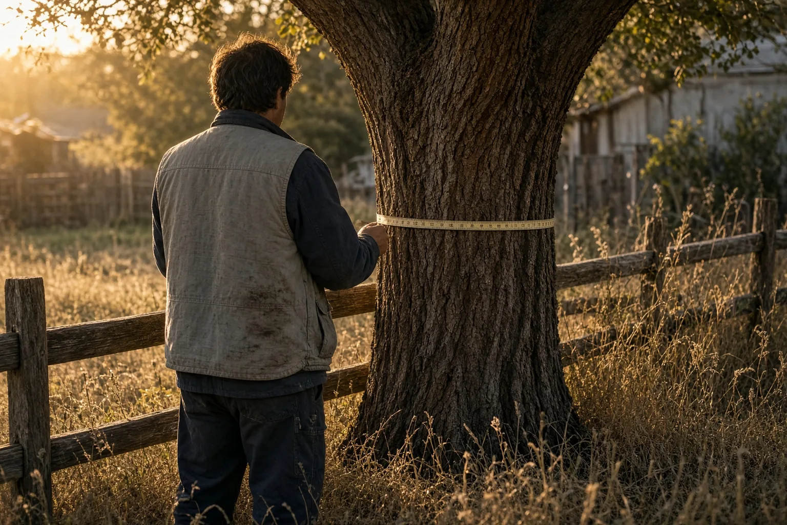
Who owns a tree that stands on the property line?
Under California Civil Code section 834, trees whose trunks stand partly on two adjoining lots belong to the owners in common. Under section 833 a trunk wholly on one lot makes the tree that owner's, even if roots cross.
Section 833 of the California Civil Code provides that trees whose trunks stand wholly upon the land of one owner belong exclusively to him, although their roots grow into the land of another. Section 834 provides that trees whose trunks stand partly on the land of two or more coterminous owners belong to them in common. The test is the trunk. Branches over the line and roots under it do not change ownership.
The California courts have read section 834 as creating a tenancy in common in the tree. In Scarborough v. Woodill, 7 Cal. App. 39 (Nov. 22, 1907), the parties owned adjoining orange orchards in Riverside County separated by a row of cypress trees on the boundary, with trunks 13 to 23 inches in diameter standing partly on each property. The court held that one tenant in common cannot divide the jointly held trees by himself.
Other states decide boundary trees under their own statutes and case law, and the rules on damages differ between them. The constant across those rules is the factual question a surveyor answers: where the boundary runs and where the trunk stands in relation to it.
How does a surveyor show where the trunk stands?
The surveyor first establishes the boundary from the deeds, plats and monuments, then locates the trunk at ground level relative to that line and reports the shares on each side. In Kallis the stump survey gave 41 and 59 percent.
The boundary comes first. A surveyor retraces the line from the record descriptions, recorded plats and the original monuments found on the ground, and does not assume that a fence, a hedge or the tree itself marks it. Only after the line is fixed does the trunk's position mean anything.
In Kallis v. Sones, 208 Cal. App. 4th 1274 (Aug. 6, 2012), an Aleppo pine about 70 feet tall grew on or near the line between two lots, and its trunk came to straddle it. A few feet up the trunk split into two large trunks, one over each property. The trunk on the plaintiffs' side measured 23 inches in diameter and the one on the defendants' side about 24 inches. A survey made after the tree was cut found that at ground level 41 percent of the stump was on the plaintiffs' lot and 59 percent on the defendants' lot.
In Kallis the shares were measured at ground level, where the trunk meets the soil; above the ground a trunk can lean or fork, as the Kallis pine did. The surveyor measures the outline of the trunk or stump at the ground, plots it against the line, and reports the location with the method, the control and the precision of the measurement. When the tree is still standing, the outline is measured at the base and photographed with the line staked.
A survey made after the cutting is still useful, as Kallis shows, but the evidence is better when it is made before. Once the stump is ground out, the location has to be reconstructed from photographs and from what is left of the root flare.
Does a fence through or beside the tree mark the boundary?
Not by itself. In Kallis a metal fence ran up through the crotch of the pine, yet ownership was decided by the survey of the stump against the boundary. A fence is located and compared with the line.
Old fences are often built along a row of trees or around a trunk, and owners treat them as the boundary. In Kallis the metal fence ran through the crotch where the trunk split, and the decisive measurement was still the survey of the stump at ground level against the property line.
A surveyor locates the fence as a separate improvement and shows its position relative to the deed line, with the distances at each end and at the tree. If the fence and the line diverge, the map shows both. Whether a long-standing fence has itself become the legal boundary under a doctrine such as acquiescence is a separate legal question, decided on evidence about how long and how the neighbors treated it.
Roots and branches are mapped the same way when they matter. A branch overhanging the line or roots under a neighbor's driveway do not make the tree a boundary tree under section 833, but their position can matter for a nuisance or damage claim, and the surveyor can show it on the same drawing.
Can one neighbor cut down a boundary tree?
Not without the other owner's consent. In Scarborough the court affirmed an injunction against cutting the remaining line trees and $100 in damages; in Kallis the neighbors who cut a shared pine did not dispute liability.
In Scarborough the defendant cut down eight of the cypress trees, every alternate pair, took the wood home for firewood and threatened to keep cutting until half the row was gone. The trial court awarded $100 and permanently enjoined him from cutting, injuring or destroying the remaining trees. The Court of Appeal affirmed and held that cutting the trees for firewood was not a legitimate use of the common estate.
As the Kallis court summarized Scarborough, neither co-owner may cut the tree without the other's consent, or cut away the part on his own land if that harms the common property. The Kallis defendants had the whole pine cut in 2008, including both secondary trunks, and left a stump. They did not contest liability and argued only about damages.
Trimming branches and roots that cross the line is a separate question with its own rules, but the rule in Scarborough limits what a co-owner may do to a tree that is common property. Before any cutting, the location of the trunk relative to the line is the first fact to establish, because it decides which rule applies.
How are damages measured, and does the 41 percent share reduce them?
In Kallis the trial court awarded $53,628.31 in restoration costs, doubled under Civil Code section 3346(a) to $107,256.62, and refused to cut it to 41 percent. The Court of Appeal affirmed.
The Kallis defendants' arborist valued the tree and proposed reducing damages to 41 percent, the plaintiffs' share of the stump. The trial court declined. It relied on the tree's unusual size and form, the benefits of its broad canopy to the plaintiffs' property and the family's attachment to it, and it awarded restoration costs because the plaintiffs were likely to replace the tree.
The award of $53,628.31 was doubled under Civil Code section 3346(a) to $107,256.62. The Court of Appeal affirmed. It held that the trial court did not err in declining to reduce the damages for the share of the trunk on the plaintiffs' land, because the tree's unusual size, form, canopy and personal value supported the full amount, and that installation and aftercare costs were part of the restoration damages and were properly doubled. The court noted that a reduction might have been appropriate if the tree had served only as lumber or a screen. Treble and punitive damages had been denied earlier on summary adjudication.
The court distinguished Happy Bunch, a Washington case, because there the parties had stipulated to the valuation method and the value. The survey share therefore did not cap the damages in Kallis, but it established the fact on which liability rested: the tree was common property under section 834.
What should neighbors do before a boundary tree is cut or trimmed?
Have the boundary surveyed and the trunk located at ground level, get the other owner's written consent if the trunk straddles the line, and document the tree's size and condition with photographs and an arborist's notes.
A survey that stakes the line at the tree answers whether section 833 or section 834 applies. If the trunk is wholly on one side, the owner of that side owns the tree. If it straddles the line, the owners hold it in common and the Scarborough rule applies.
The size, species and condition of the tree are recorded before anything is done: trunk diameter at a stated height, height, canopy spread, signs of disease or structural defects, and photographs from both lots. In Kallis the damages turned on the size and form of the tree and the value of its canopy to one lot, facts that are easier to prove from records made before the cutting.
If the neighbors disagree, the dispute moves to counsel. The surveyor's map and report are evidence of the location; the arborist's report is evidence of condition and value; the decision whether to sue for an injunction or damages is a legal one.
What does a court check in the surveyor's evidence?
The records and monuments used to fix the line, how the trunk was measured and at what height, and the precision of the result. In federal court the opinion must meet Rule 702.
A surveyor's report on a boundary tree is an expert opinion on two facts: where the boundary runs and where the trunk stands. The court checks the record documents and the monuments found, the measurement method and control, and whether the trunk outline was taken at ground level. A report that shows only a line drawn through a symbol for the tree does not answer the section 834 question.
In federal court Rule 702 of the Federal Rules of Evidence, as amended in 2023, requires the proponent to show that it is more likely than not that the opinion rests on sufficient facts or data and on reliable principles and methods reliably applied to the facts. State courts apply their own evidence codes.
Under Rule 34(a)(2) of the Federal Rules of Civil Procedure a party may request entry onto land the other party possesses or controls to inspect, measure, survey, photograph, test or sample it, with a written response due within 30 days after service. A surveyor who needs to locate a trunk on the neighbor's side uses this procedure, or the state equivalent, when access is refused.
What does IAE prepare in a dispute over a tree on the property line?
An expert report on where the line runs, where the trunk stands and whether improvements encroach, or a review of the opposing surveyor's report, in up to 5 business days after format and cost are confirmed.
The IAE boundary survey page covers boundary, quiet title and encroachment cases in US courts: where the deed line runs on the ground, whether two descriptions overlap, whether a fence or a building encroaches. The surveyor collects deeds, recorded plats and original field notes, searches for the original monuments, measures with GNSS and a total station and locates fences, driveways and buildings relative to the line. The client sends the deeds, plats and any prior surveys with the request, and for a tree dispute photographs of the tree or stump from both lots and any arborist's report.
The secretariat confirms receipt the same day. IAE then confirms the format, the cost, the deadline and the specialist from its registry, and the client approves the candidate and the CV before work starts. The signed PDF is issued in up to 5 business days, and cases with tight deadlines have a 48-hour rush.
Every specialist is a member of the public IAE registry and can be verified by Member ID or QR code. The specialist confirms in the document that he or she has no interest in the outcome of the case. Neither IAE nor the surveyor guarantees the outcome. IAE is not a law firm and does not advise on case strategy.
Sources
- California Civil Code section 833 (FindLaw, current as of January 1, 2026)
- California Civil Code section 834 (FindLaw, current as of January 1, 2026)
- Scarborough v. Woodill, 7 Cal. App. 39 (Cal. Ct. App. Nov. 22, 1907)
- Kallis v. Sones, 208 Cal. App. 4th 1274 (Cal. Ct. App. Aug. 6, 2012)
- Federal Rules of Evidence, Rule 702 (LII, Cornell Law School)
- Federal Rules of Civil Procedure, Rule 34 (LII, Cornell Law School)
Read also
All articles
Neighbor removed the survey markers: is it illegal, who pays to reset them, and what does the surveyor document?
A survey is finished, the corners are pinned, and a week later the pins are gone. In Washington intentionally disturbing a survey monument is a gross Sergei Voronin

Road right of way and the property line: where does the public road end and my lot begin?
Where a lot meets a public road, the line is the edge of the right of way or a line the deed sets, not the edge of the pavement. In Florida a roadSergei Voronin
Neighbor built too close to the property line: how does a surveyor prove a setback violation, and what can be done about it?
A setback is the space a zoning code requires between a structure and the property line. A neighbor who builds inside it has not necessarily crossedSergei VoroninExpert examinations
Ready to discuss your case?
Send the materials: the secretariat will confirm the format, cost, deadline and the specialist within one business day.